 Click on image to enlarge. | Global CoverageRelease Date: February 22, 2013 Topics: Color Images, Global Views, HD Resolution Images |
Instrument: Mercury Dual Imaging System (MDIS)
Center Latitude: 0°
Center Longitude: 75° E
Scale: Mercury's diameter is 4880 kilometers (3030 miles).
Map Projection: orthographic
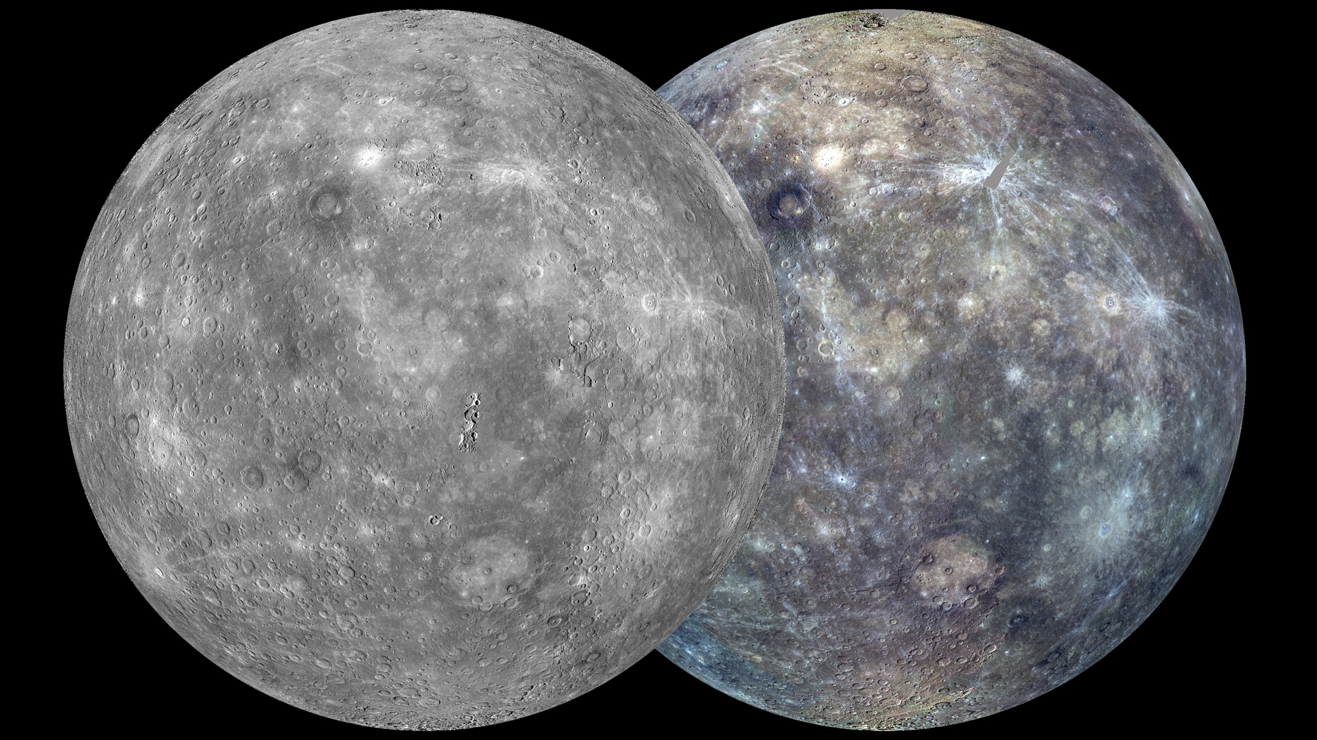
Of Interest: The view shown here is similar to an earlier one, posted in October 2011, but now the coverage is more complete. The globe on the left was created from the MDIS monochrome surface morphology base map campaign. The globe on the right was produced from the MDIS color base map campaign. Each map is composed of thousands of images, and the color view was created by using 3 of the 8 color filters acquired. (1000, 750, and 430 nm wavelengths are displayed in red, green, and blue, respectively.) On March 8, 2013, these global maps will be publicly released at full resolution by NASA's Planetary Data System.
The MESSENGER spacecraft is the first ever to orbit the planet Mercury, and the spacecraft's seven scientific instruments and radio science investigation are unraveling the history and evolution of the Solar System's innermost planet. Visit the Why Mercury? section of this website to learn more about the key science questions that the MESSENGER mission is addressing. During the one-year primary mission, MESSENGER acquired 88,746 images and extensive other data sets. MESSENGER is now in a yearlong extended mission, during which plans call for the acquisition of more than 80,000 additional images to support MESSENGER's science goals.
Center Latitude: 0°
Center Longitude: 75° E
Scale: Mercury's diameter is 4880 kilometers (3030 miles).
Map Projection: orthographic
Of Interest: The view shown here is similar to an earlier one, posted in October 2011, but now the coverage is more complete. The globe on the left was created from the MDIS monochrome surface morphology base map campaign. The globe on the right was produced from the MDIS color base map campaign. Each map is composed of thousands of images, and the color view was created by using 3 of the 8 color filters acquired. (1000, 750, and 430 nm wavelengths are displayed in red, green, and blue, respectively.) On March 8, 2013, these global maps will be publicly released at full resolution by NASA's Planetary Data System.
The MESSENGER spacecraft is the first ever to orbit the planet Mercury, and the spacecraft's seven scientific instruments and radio science investigation are unraveling the history and evolution of the Solar System's innermost planet. Visit the Why Mercury? section of this website to learn more about the key science questions that the MESSENGER mission is addressing. During the one-year primary mission, MESSENGER acquired 88,746 images and extensive other data sets. MESSENGER is now in a yearlong extended mission, during which plans call for the acquisition of more than 80,000 additional images to support MESSENGER's science goals.
Credit: NASA/Johns Hopkins University Applied Physics Laboratory/Carnegie Institution of Washington
For information regarding the use of MESSENGER images, see the image use policy.