Explore / Multimedia
Videos
Mission Videos    Movies   Animations

Mission Videos

Watch videos that discuss the MESSENGER mission, its development, and the science questions that the mission is addressing. For information regarding the use of MESSENGER images and videos, see the image use policy.

Is a lander next for Mercury?

Sean Solomon - April 24, 2015

Is the mission over at impact?

Nancy Chabot, David Lawrence, Catherine Johnson - April 24, 2015

Where did career get started?

Larry Nittler, Paul Byrne, Nancy Chabot, Steven Hauck - April 23, 2015
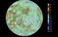
What's the team like?

Steven Hauck, Brian Anderson, Tom Krimigis, David Lawrence, Nancy Chabot - April 22, 2015

What do the lava flows have to do with Mercury's contraction?

Paul Byrne, Steven Hauck - April 22, 2015

What have we learned about volcanism?

Larry Nittler, Paul Byrne - April 21, 2015

Does Mercury have a radiation belt?

Tom Krimigis, David Lawrence - April 21, 2015

 How as technology affected the imaging of Mercury?

Carolyn Ernst, Rob Gold - April 20, 2015

What can you tell us about the hollows on Mercury?

Ralph McNutt, Carolyn Ernst - April 20, 2015

What can we learn from Mercury?

Larry Nittler, Paul Byrne, Brian Anderson - April 17, 2015

What data will Mercury produce?

Brian Anderson, Ralph McNutt, Sean Solomon - April 17, 2015

What is SciBox and how did it contribute to mission success?

Josh Steele, Bill Feldman, Bill Jaskulek, Brian Anderson - April 16, 2015

 What is Mercury made of?

Sean Solomon, Steven Hauck - April 16, 2015

What have we learned about water ice?

Carolyn Ernst, Nancy Chabot - April 15, 2015

Was the mission a success?

Sean Solomon - April 15, 2015

What's it like making a discovery?

Brian Anderson, Sean Solomon, Larry Nittler - April 14, 2015

What type of science is happening during these extended missions?

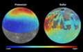
Haje Korth, Catherine Johnson, Larry Nittler - April 13, 2015

What obstacles did MESSENGER face in getting to Mercury and into orbit?

Dan O'Shaughnessy, Ralph McNutt, Sean Solomon - April 13, 2015

Movies

Watch movies acquired by the MESSENGER mission during its planetary encounters. Also watch the many preparations involved as the MESSENGER spacecraft was readied for its journey and then launched successfully from Cape Canaveral, Florida on August 3, 2004. For information regarding the use of MESSENGER images and videos, see the image use policy.

Making Mercury Whole

The First Global Topography of the Innermost Planet

Download the full-resolution MP4 [150 MB]

An animation of the new global digital elevation model (DEM) created from MESSENGER images. Mercury's surface is colored according to the topography of the surface, with regions with higher elevations colored brown, yellow, and red, and regions with lower elevations appearing blue and purple.
Credit: NASA/U.S. Geological Survey/Arizona State University/Carnegie Institution of Washington/Johns Hopkins University Applied Physics Laboratory

Making Mercury Whole

Making Mercury Whole

Download MP4

In this movie, MESSENGER team members recount some highlights of the mission, originally planned to orbit Mercury for only one year, but ultimately orbiting the planet for more than four years. This movie was released on August 3, 2015, the 11th anniversary of the launch of the MESSENGER spacecraft.

MESSENGER's Top 10 Science Results

MESSENGER's Top 10 Science Results

View movies of the mission's top science results, as presented at a NASA media and public event on April 16, 2015.

MESSENGER's Top 10 Technology Innovations

MESSENGER's Top 10 Technology Innovations

View movies of the mission's top technology innovations, as presented at the NASA media and public event held on April 16, 2015.

Lunar Eclipse, as Viewed by MESSENGER

Lunar Eclipse, as Viewed by MESSENGER

Download MP4

This movie shows the total lunar eclipse of October 8, 2014, as viewed by MESSENGER. From Mercury, the Earth and Moon normally appear as if they were two very bright stars. During a lunar eclipse, the Moon seems to disappear during its passage through the Earth's shadow. This movie was constructed from 31 images taken two minutes apart, from 9:18 UTC to 10:18 UTC. The images start just before the Moon entered the darkest part of the Earth's shadow (the umbra).

Credit: NASA/Johns Hopkins University Applied Physics Laboratory/Carnegie Institution of Washington

Movie of VIRS Raster Scan

Download MP4

Credit: NASA/Johns Hopkins University Applied Physics Laboratory/Carnegie Institution of Washington

This movie demonstrates a MASCS VIRS raster scan. The target is Lermontov crater in Mercury's mid latitudes, for which 258 spectra were consecutively taken 1 to 5 seconds apart. Each spectrum (green) is compared to Mercury's mean spectrum (black) between wavelengths of 300nm and 1450nm.

The MESSENGER Flyover Movie

The MESSENGER Flyover Movie

Downloads: Captioned - full-size [187 MB], compressed [14.7 MB]    |    Broadcast ready - with [182 MB] and without [119 MB] flanked sponsor logos

Credit: NASA/Johns Hopkins University Applied Physics Laboratory/Carnegie Institution of Washington

The MESSENGER Flyover Movie consists of 214 images acquired by the spacecraft's Narrow Angle Camera (NAC) on June 8, 2014. The NAC field of view looks toward the horizon along the direction of spacecraft motion as the probe crossed the terminator into night. MESSENGER flew over Mercury's north polar region, providing views of the planet's cratered terrain. Information in the available captioned version includes image acquisition time, local solar time, image location, spacecraft altitude, and image resolution. Broadcast-ready versions are also available. For additional details of what this movie illustrates, visit this aerial view and this higher-resolution mosaic of MESSENGER's flight path.

Ride Along with MESSENGER: Movie 1

Ride Along with MESSENGER: Movie 1

Download mov

Credit: NASA/Johns Hopkins University Applied Physics Laboratory/Carnegie Institution of Washington

This movie was assembled from 284 individual NAC images acquired on 4 October, 2013. Most of the images were acquired 4 seconds apart, the fastest that MDIS was capable of taking full resolution images, but this movie is shown with 15 images per second. In the second half of the movie, Mirni Rupes can be seen in the top right. These images were acquired as part of the NAC ride-along imaging campaign.

Ride Along with MESSENGER: Movie 2

Ride Along with MESSENGER: Movie 2

Download mov

Credit: NASA/Johns Hopkins University Applied Physics Laboratory/Carnegie Institution of Washington

This movie was assembled from 289 individual NAC images acquired on 4 October, 2013. Most of the images were acquired 4 seconds apart, the fastest that MDIS was capable of taking full resolution images, but this movie is shown with 15 images per second. The movie begins centered on the 191-km diameter Schubert basin. These images were acquired as part of the NAC ride-along imaging campaign.

A Tribute to MESSENGER

A Tribute to MESSENGER

Download MP4

Credits: Images and animation stills courtesy NASA/Johns Hopkins University Applied Physics Laboratory/Carnegie Institution of Washington.
Music: "Mercury Ridge" by Simon Wilkinson (thebluemask.com). Video creation and time-lapse animations by Mark 'Indy' Kochte.

This video showcases a small sampling of the thousands of images taken by the spacecraft, as well as animations illustrating how MESSENGER moves in orbit and how its orbit has changed during the mission. For additional details of the animations and images in the video, visit this featured image.

Watch Mercury Spin on its Axis

Watch Mercury Spin on its Axis

Download mov

Credit: NASA/Johns Hopkins University Applied Physics Laboratory/Carnegie Institution of Washington.

This movie shows Mercury's globe as it rotates. A global color map of Mercury's surface has been created by mosaicking thousands of sets of images obtained by the MESSENGER Wide Angle Camera (WAC). The colors shown here are related to real variations in the spectral reflectance across the planet. This view captures both compositional differences and differences in how long materials have been exposed at Mercury's surface. Young crater rays, arrayed radially around fresh impact craters, appear light blue or white. Medium- and dark-blue areas are a geologic unit of Mercury's crust known as the "low-reflectance material," thought to be rich in a dark, opaque mineral. Tan areas are plains formed by eruption of highly fluid lavas. The color base map shown here consists of MDIS images taken through eight different color filters. It is part of a global color map that covers more than 99% of Mercury's surface with an average resolution of about 1 kilometer per pixel.

Perspective View of Mercury's Rachmaninoff Basin

Perspective View of Mercury's Rachmaninoff Basin

Download mov

Credit: NASA/Johns Hopkins University Applied Physics Laboratory/Carnegie Institution of Washington/Planetary Science Institute.

This is a movie of Mercury's Rachmaninoff impact basin. An enhanced-color image has been draped over a digital elevation model of the surface. The vertical exaggeration is 7 times. The basin's outer rim is about 306 km in diameter and the inner (peak) ring is about 140 km in diameter. The volcanic smooth plains within the center appear tan in this presentation, emphasizing their compositional contrast with the dark, bluer rocks that form the peak ring mountains. Images from the Mercury Dual Imaging System on board NASA's MESSENGER spacecraft were processed to provide the color and elevation information used to create this view.

Illumination at Mercury's North Pole

Illumination at Mercury's North Pole

Download MP4

Credit: NASA Goddard Space Flight Center/Massachusetts Institute of Technology/Johns Hopkins University Applied Physics Laboratory/Carnegie Institution of Washington.

This animation displays the illumination of the topography of Mercury's north polar region, showing the small proportion of sunlight that reaches the Prokofiev crater floor and rim. The north-facing portions of the rim and interior remain in perpetual shadow, as do those of numerous other craters. The movie simulates approximately one half of a Mercury solar day (176 Earth days) and uses the digital terrain model derived from MLA measurements. Contrast has been enhanced for television display.

Mercury's South Pole over One Mercury Solar Day

Mercury's South Pole over One Mercury Solar Day

Download mov

This movie shows 89 wide-angle camera (WAC) images of Mercury's south polar region acquired by the Mercury Dual Imaging System (MDIS) over one complete Mercury solar day (176 Earth days) in 2011. This dataset enabled the illumination conditions at Mercury's south polar region to be quantified and the identification of areas of permanent shadow. Each image is shown in polar stereographic projection, extending northward to 73° S, and 0° longitude is at the top. The large crater near Mercury's south pole, Chao Meng-Fu, has a diameter of 180 km.

Visualization of Mercury's Space Environment

Visualization of Mercury's Space Environment

Download mov

Watch a visualization of measurements of sodium-group ion flux (blue) and magnetic field (red) during MESSENGER's orbit on 14 April 2011. Sodium-group ions are measured throughout the entire magnetosphere, but they strongly peak near the magnetic cusps, where the magnetic protection of the planet is least effective. Measurements from more than 120 orbits were used to assemble a global picture of Mercury's three-dimensional exosphere.

Distribution of Energetic Electron Events Recorded by MESSENGER

Distribution of Energetic Electron Events Recorded by MESSENGER

Download mov

Watch a movie that shows the locations at which energetic electrons were detected by MESSENGER between March 24 and June 3, 2011. In the coordinate system used (known as the Mercury solar orbital, or MSO, coordinates), the Sun is always in a fixed direction (here +X-axis). The events are well distributed in local time, but most are seen when the spacecraft is in the northern hemisphere. MESSENGER's X-ray Spectrometer (XRS) responds to electrons initially with lower energies but in a manner analogous to the GRS.

Mercury's Magnetic Equator Versus Longitude

Mercury's Magnetic Equator Versus Longitude

Download mov

Watch a movie that shows the location of Mercury's magnetic equator determined on successive orbits as the point where the direction of the internal magnetic field is parallel to the spin axis of the planet. This magnetic equator is well north of the planet's geographic equator (indicated by the horizontal gray line). The best-fitting internal dipole magnetic field is located about 0.2 Mercury radii, or 480 km, northward of the planet's center.

Movie of MLA Coverage

Movie of MLA Coverage

Download mov

Watch a movie that shows the MLA profiles acquired between 29 March and 24 May. Elevation along track (relative to a sphere of radius 2,440 km) is shown by the color scale. Note the broad area of generally low elevations in Mercury's north polar region. The total range in elevation measured by MLA to date is more than 9 km. Orthographic projection centered on the north pole; the outmost circle corresponds to Mercury's equator.

Movie of Global Imaging Coverage

Movie of Global Imaging Coverage

Download mov

Watch a movie that shows the current monochrome imaging coverage as of June 16, 2011, centered at 240° E, and zooms in to highlight one of the many striking features seen during the first few months of orbital operations. At 9.0° S, 254.7° E, impact melt flowed from an unnamed, 13-km-diameter impact crater, extending outward more than one crater diameter from the rim.

MESSENGER's Departing Shots from the Mission's Second Mercury Flyby

MESSENGER's Departing Shots from the Mission's Second Mercury Flyby

Download mov

Watch a movie created by compiling images taken as MESSENGER departed Mercury following flyby 2 on October 6, 2008.

A Color Movie of Mercury's Surface

A Color Movie of Mercury's Surface

Download mov

View an enhanced color movie created using images from MESSENGER's second Mercury flyby on October 6, 2008.

Magnetometer Measurements during Mercury Flyby 2

Magnetometer Measurements during Mercury Flyby 2

Download mov

Click here to watch an animation showing a zoom-in of MESSENGER's second Mercury flyby outbound magnetopause crossing, showing nine seconds of magnetic field data from October 6, 2008.

Observations of Mercury's Exosphere from MESSENGER's Second Mercury Flyby

Observations of Mercury's Exosphere from MESSENGER's Second Mercury Flyby

Download mov

Click here to view an animation illustrating how the Mercury Atmospheric and Surface Composition Spectrometer (MASCS) observed the tail region of Mercury's exosphere during the mission's second flyby of the planet on October 6, 2008.

Mercury Flyby 1: MESSENGER Departs Mercury

Mercury Flyby 1: MESSENGER Departs Mercury

mov | wmv

Credit: NASA/Johns Hopkins University Applied Physics Laboratory/Carnegie Institution of Washington

Watch the movie created from images taken by MESSENGER as it departed Mercury after the flyby on January 14, 2008.

As MESSENGER completed its successful flyby of Mercury, the Narrow Angle Camera (NAC), part of the Mercury Dual Imaging System (MDIS), took images of the planet as the spacecraft departed. Beginning on January 14, 2008, about 100 minutes after MESSENGER's closest pass by the surface of Mercury, until January 15, 2008, about 19 hours later, the NAC acquired one image every four minutes. In total, 288 images were snapped during this time and were compiled sequentially to produce this movie. At the start of the movie, MESSENGER is about 34,000 kilometers (about 21,000 miles) from Mercury, and the first image has a field of view of about 950 kilometers (about 590 miles) in width. At the end of the movie, the MESSENGER spacecraft is a distance of about 440,000 kilometers (270,000 miles) from Mercury.

This movie shows the end of MESSENGER's first encounter with Mercury. MESSENGER flew by Mercury two additional times during the mission, in October 2008 and September 2009. In March 2011, MESSENGER entered into an orbit around Mercury and began a year-long scientific investigation of the planet.

MESSENGER Flies through Mercury's Magnetosphere

MESSENGER Flies through Mercury's Magnetosphere

mov | wmv

Credit: NASA/Johns Hopkins University Applied Physics Laboratory/Carnegie Institution of Washington

Watch an animation of the MESSENGER spacecraft flying through Mercury's magnetosphere on January 14, 2008, with the corresponding results obtained from the Fast Imaging Plasma Spectrometer (FIPS) instrument. This animation shows a conceptual sketch of Mercury’s magnetosphere at the time of the MESSENGER flyby. The graphs at the bottom show observations made by the Fast Imaging Plasma Spectrometer (FIPS) portion of the Energetic Particle and Plasma Spectrometer (EPPS) instrument as the spacecraft followed the indicated trajectory. The top plot depicts the low-energy plasma of solar wind origin, and the bottom plot shows heavy ion intensities associated with the planet. This flyby was the first survey of the ion plasma of Mercury's space environment. The positions at which the spacecraft first crossed the "bow shock" of the magnetospheric interaction with the solar wind, passed closest approach to the planet, and crossed the outbound bow-shock crossing are indicated.

These results show the expected increases in solar wind plasma density downstream of the bow-shock boundary, as well as significant solar wind plasma densities within Mercury's magnetosphere close to the planet. The latter measurements provide definitive evidence that Mercury's magnetosphere – despite its small size – is not a vacuum but hosts significant densities of heated solar wind plasma. The plasma affects the magnetic field, contributes to the "space weathering" of the planet’s surface, and sputters material from the surface to populate the exosphere. This first detection of heavy pick-up ions, Na+ and other species, near Mercury is consistent with their production by ionization of exospheric neutral species. This complex system and all of its time variations were studied during the MESSENGER flybys as well as throughout the orbital phase of the mission.

MESSENGER Approaches Mercury during Mercury Flyby 1

MESSENGER Approaches Mercury during Mercury Flyby 1

mov | wmv

Credit: NASA/Johns Hopkins University Applied Physics Laboratory/Carnegie Institution of Washington

Watch a movie created from images taken by MESSENGER as the spacecraft approach Mercury and prepared for its flyby on January 14, 2008.

On January 13, 2008, beginning 30 hours before MESSENGER's closest approach to Mercury, the Wide Angle Camera, part of the Mercury Dual Imaging System (MDIS), began snapping images as it approached the planet. Over this period, MESSENGER imaged the planet once every 20 minutes to produce this approach sequence, which has been compiled into a movie. At the start of the movie, the MESSENGER spacecraft is about 630,000 kilometers (about 390,000 miles) from Mercury. The movie ends when MESSENGER is about 34,000 kilometers (about 21,000 miles) from Mercury and about 100 minutes before its closest approach, when it passed a mere 200 kilometers (124 miles) above Mercury's surface.

In the approach movie, Mercury appears as a sunlit crescent. During the encounter, MESSENGER passed over the night side of the planet, experienced its closest approach with Mercury, and then emerged into daylight. This encounter was the first of three flybys of Mercury for the MESSENGER mission.

Keeping a Rendezvous with Mercury for the Mission's First Mercury Flyby

Keeping a Rendezvous with Mercury for the Mission's First Mercury Flyby

Download mov (1.6 MB)

Watch a movie created from the optical navigation images taken as MESSENGER approached Mercury for its first flyby.

Between January 9 and 13, 2008, as the MESSENGER probe approached Mercury for its first flyby, the Narrow Angle Camera, part of the Mercury Dual Imaging System (MDIS), acquired a series of images of the planet in support of spacecraft navigation. These images have been put together as frames in a movie. The final frame of the movie has the highest spatial resolution (20 km/pixel, 12 miles/pixel) and was recorded when the spacecraft was at a distance of about 760,000 kilometers (470,000 miles) from Mercury. Mercury is about 4880 kilometers (about 3030 miles) in diameter.

As part of MESSENGER's flyby on January 14, MDIS obtained high-resolution image sequences with the Narrow Angle Camera, and the Wide Angle Camera collected images in eleven colors. The images covered portions of the planet never before seen by spacecraft, as well as regions that were photographed by Mariner 10 in 1974 and 1975. The new data for the previously studied areas of Mercury helped scientists interpret the data for the parts of the planet that MESSENGER revealed for the first time.

MESSENGER Bids Farewell to Venus

MESSENGER Bids Farewell to Venus

Download MPG (3 MB)

Watch MESSENGER depart Venus during its second flyby of the planet on June 5, 2007. The MESSENGER spacecraft completed its second close encounter with Venus on June 5, 2007. As the spacecraft departed from the planet the Wide Angle Camera captured a sequence of 50 images showing Venus disappearing in the distance. MESSENGER was 60,688 kilometers (37,710 miles) from the planet at the start of the sequence and 89,310 kilometers (55,495 miles) at the end. Initially, images were acquired at a rate of one of every 20 minutes, and then as Venus shrank the timing interval was increased to 60 minutes. These images represent the last view of Venus by MESSENGER, but they also point toward the spacecraft's first encounter with Mercury in January 2008.

The January flyby provided the MESSENGER team with its first science observations of its prime target, Mercury. The Venus flyby provided the mission operations team an opportunity to complete successfully a full test of the complicated series of spacecraft motions required to build up high-resolution image mosaics at Mercury. Mariner 10 imaged only one hemisphere of Mercury in 1974-75. During the third flyby MESSENGER instruments photographed and made measurements of half of the hemisphere viewed by Mariner 10 and half of the hemisphere never before imaged by spacecraft. MESSENGER captured the rest of the planet in subsequent flybys in October 2008 and September 2009. In March 2011 MESSENGER was inserted into orbit about Mercury, allowing detailed observations of the planet for a full Earth year. Departure sequence consists of MDIS frames EW0089578826F through EW0089670026F (430-nm wavelength filter).

Earth Departure Movie

Earth Departure Movie

Download Earth rotation (4.90 MB) or Earth rotation with date and time (5.78 MB).

The Mercury-bound MESSENGER spacecraft captured several stunning images of Earth during a gravity assist swingby of its home planet on Aug. 2, 2005. Several hundred images, taken with the wide-angle camera in MESSENGER's Mercury Dual Imaging System (MDIS), were sequenced into a movie documenting the view from MESSENGER as it departed Earth.

Comprising 358 frames taken over 24 hours, the movie follows Earth through one complete rotation. The spacecraft was 40,761 miles (65,598 kilometers) above South America when the camera started rolling on Aug. 2. It was 270,847 miles (435,885 kilometers) away from Earth - farther than the Moon's orbit - when it snapped the last image on Aug. 3.

The Launch of MESSENGER

The Launch of MESSENGER

Download MPG

Watch the MESSENGER spacecraft successfully launch from Cape Canaveral, Florida on August 3, 2004.

Pre-launch Assembly and Loading Operations

Pre-launch Assembly and Loading Operations

Part 1 (MPG, 20.1 MB) | Part 2 (MPG, 20.2 MB)

View the final assembly stages of the MESSENGER spacecraft and its incorporation onto the launch vehicle.

Pre-launch Assembly and Loading Operations

Movies of MESSENGER's Assembly

Watch daily movies of the assembly of the MESSENGER spacecraft, from March 2003 until the launch in August 2004 (click here).

Animations

Download these animations to view MESSENGER's path through the inner solar system, gravity-assist flybys of Earth, Venus, and Mercury, and a view of Mercury from orbit. The animations, created using Satellite Tool Kit (STK) software by Analytical Graphics, Inc., are offered in a variety of file sizes and resolution qualities. Additional Venus flyby animations were created using SOAP (Satellite Orbit Analysis Program) software from the Aerospace Corporation. The planetary flyby and Mercury orbit insertion times, shown in UTC (Coordinated Universal Time), and corresponding altitudes reflect the best knowledge at the time the events were planned. For information regarding the use of MESSENGER images and videos, see the image use policy.

A Visual Perspective of MESSENGER's Comet Observation Campaign

A Visual Perspective of MESSENGER's Comet Observation Campaign

Download mov (8 MB)

This animation shows an oblique sunward view from north of the orbit of Mercury. In the animation, the MESSENGER spacecraft orbits Mercury once every eight hours, and portions of the orbits of comets Encke and 2012 S1 (ISON) may be seen. Access lines connect the image of comet Encke or representation of comet ISON to the location of MESSENGER whenever the spacecraft was in a position of a planned comet observation. The colored text indicates the frequency of observations and the distances in AU from each comet to the Sun and to the MESSENGER spacecraft. (The image of the comet Encke was used with permission from United Kingdom's Damian Peach.)

MLA Measurements

MLA Measurements

Download MP4

Credit: Scientific Visualization Studio, NASA Goddard Space Flight Center.

The Mercury Laser Altimeter (MLA) is shown ranging to Mercury's surface from orbit in this animation. Yellow flashes represent near-infrared laser pulses that can reflect off terrain in shadow as well as in sunlight. Using only about as much power as a flashlight, the MLA instrument ranged eight times per second to targets at distances approximately as far as that from Washington, D.C. to Ottawa, Canada (~800 km), or to Orlando, Florida (~1200 km). The laser pulse returned from the surface in less than one hundredth of a second. This time interval could be measured to a precision equivalent of a hand's breadth uncertainly in distance. Measurements were assembled from individual profiles to produce a terrain model such as the one shown here.

MLA in Operation

MLA in Operation

Downloads (large mov, 140 MB | small mov, 28 MB)

This animation is a schematic illustration of the operation of MESSENGER's Mercury Laser Altimeter (MLA). MLA ranged to Mercury whenever the spacecraft was within 1,800 km of the surface. Eight times per second, MLA's laser emitted a short (5 ns) pulse, which propagated along the laser transmitter's line of sight to the surface, where a fraction of the pulse energy was reflected from the surface and propagated back to MLA's four receiver telescopes. The time of flight of the laser pulse provided the distance to the targeted portion of the surface. Knowledge of the spacecraft's position then allowed recovery of the elevation of the reflection point.

GRNS in Operation

GRNS in Operation

Downloads (large mov, 12.8 MB | small mov, 3.4 MB)
This is a schematic illustration of the operation of MESSENGER's Gamma-ray and Neutron Spectrometer (GRNS). Detection of gamma-rays and neutrons by GRNS allowed scientists to determine the chemical composition of the surface. For instance, gamma-rays can be used to detect a number of elements such as sodium, potassium, and uranium, and neutrons are especially good at detecting hydrogen, which when found in abundance can be an indicator of water ice. Find out more from team members in  the mission videos: "What was one of the things the neutron spectrometer told us about Mercury's surface?" and "The importance of the measurements made by the Gamma-ray and Neutron Spectrometer during the flyby," in the Explore > Videos > Mission Videos section of this page.

XRS in Operation

XRS in Operation

Downloads (large mov-5.8 MB | small mov-2.4 MB)

This is a schematic illustration of the operation of MESSENGER's X-ray Spectrometer (XRS). When X-rays emitted from the Sun's corona strike the planet, they can induce X-ray fluorescence from atoms at the surface. Detection of these flourescent X-rays allows determination of the surface chemical composition.

Launch to Orbit

Launch to Orbit

Downloads: View MESSENGER's journey from Launch (mov-28 MB) or view the journey with Earth's orbital motion frozen (mov-75.5 MB | m4v-6.6 MB).

View MESSENGER's journey from launch on August 3, 2004, through Earth, Venus, and Mercury flybys, to its arrival at Mercury on March 18, 2011. Check out the relative motions of Earth, Venus, Mercury; the MESSENGER spacecraft trajectory; nearly 16 spacecraft orbits around the Sun; and the orbits of Earth, Venus and Mercury in the plane of Earth's orbit. Use the timeline at the bottom to track the spacecraft's progress from launch to Mercury orbit insertion.

Then in the second animation, view the same journey but from a different perspective, with Earth's orbital motion frozen. This animation shows, while MESSENGER is in the "solar conjunction" region (shown as a yellow-shaded region in the upper left), interference from the Sun can reduce or prevent communication with the spacecraft.

Launch

Launch

View Earth from MESSENGER (13.2 MB or 5.8 MB) or see the spacecraft's path from high above Asia (5.6 MB or 1.6 MB) beginning at launch on August 3, 2004. The view from MESSENGER features night lights of Florida and a close-up view of southern Africa.

Earth Flyby

Earth Flyby

Ride along with MESSENGER (17.9 MB or 6.0 MB) or watch from high above northern Asia (8.7 MB or 3.8 MB) as the spacecraft flies by Earth on August 2, 2005. The view from above northern Asia depicts the spacecraft flying above, not through, Earth's shadow.

XXXXX

Venus Flyby 1

Soar over Venus' cloud deck on October 24, 2006. Two views show the encounter from MESSENGER's perspective (8.0 MB or 4.2 MB) or from above Venus' north pole (7.2 MB or 3.9 MB).

Venus Flyby 1 - additional view

Venus Flyby 1 - Trajectory and Additional Views

The MESSENGER flyby trajectory and Venus Express orbit around Venus (7.6 MB) have tick marks every 30 minutes and a line-of-sight path (though no communication is possible) between each spacecraft. The marker for MESSENGER changes color during eclipse when Venus blocks sunlight from reaching the spacecraft. Venus Express orbit data is courtesy of Trevor Morley of the European Space Agency.

View the surface features of Venus that MESSENGER flew over in this animation, (45.1 MB). The red line with time ticks every two minutes shows the surface directly below the spacecraft. Thick clouds above Venus and limited spacecraft activity during the flyby prevented the spacecraft's instruments from observing the planet's surface. Topographic maps are courtesy of Ralph Aeschliman.

Venus Flyby 2

Venus Flyby 2

Follow MESSENGER's second trip over Venus on June 5, 2007. Choose from MESSENGER's view (7.6 MB or 4.9 MB) or from above Venus' north pole (6.7 MB or 3.7 MB).

As the MESSENGER spacecraft approached the brightly illuminated Venus it began a carefully planned sequence of science observations that were designed to practice activities that would again be executed seven months later at the first flyby of Mercury. This animation shows the approximate spacecraft orientation from one hour before closest approach to one hour after the 338 kilometer altitude closest approach. Venus is shown in the background. (8.4 MB)

Venus Flyby 2 - additional views

Venus Flyby 2 - Trajectory and Additional Views

The MESSENGER flyby trajectory and Venus Express orbit around Venus are shown in this animation (21.2 MB), with tick marks every 30 minutes and a line-of-sight path (through no communication is possible) between each spacecraft. Notice how the MESSENGER spacecraft model becomes dimmer and how the line-of-sight between MESSENGER and Venus Express disappears as the spacecraft passes through solar eclipse (the shadow of Venus). Preliminary planned movements of the MESSENGER spacecraft also appear in the animation. The animation shows the best publicly available predicted position and orbit orientation at the time (not the planned spacecraft orientation) of the Venus Express spacecraft.

View the surface features of Venus that MESSENGER flew over (11.2 MB). The red line with time ticks every two minutes shows the surface directly below the spacecraft. Thick clouds above Venus and spacecraft pointing limits prevented many of the spacecraft's science instruments from observing the surface of Venus. Topographic maps courtesy of Ralph Aeschliman.

Venus Flyby 2 Instrument Operations

Venus Flyby 2 - Instrument Operations

This animation (6.2 MB or 37.4 MB) shows the planet Venus with its center fixed in the middle of the field of view as MESSENGER flew by the planet obtaining a gravity assist. The maneuvers shown for the spacecraft correspond to the programmed pointing and data collection sequences implemented in the actual flyby. Large rectangular fields of view indicate imaging with the Wide Angle Camera of the Mercury Dual Imaging System (MDIS); smaller fields of view correspond to images made with the Narrow Angle Camera of the same instrument. Other remote-sensing instrument footprints are shown as well, noted with labels in the animation.

Mercury Flyby 1

Mercury Flyby 1

On January 14, 2008, MESSENGER flew over the eastern side of Mercury's never-before-imaged hemisphere. Mariner 10 images are projected onto the globe of Mercury in these animations. See the encounter from MESSENGER (9.28 MB or 4.70 MB) and over Mercury's north pole (3.00 MB or 1.82 MB).

Mercury Flyby 1 Instrument Operations

Mercury Flyby 1 Instrument Operations

This animation (10.4 MB or 84.2 MB) shows the planet Mercury as MESSENGER flies by the planet for the first time during the mission. The maneuvers shown for the spacecraft correspond to the pointing and data collection sequences planned for the flyby. Large rectangular fields of view indicate imaging with the Wide Angle Camera of the Mercury Dual Imaging System (MDIS); smaller fields of view correspond to images made with the Narrow Angle Camera of the same instrument. Other remote-sensing instrument footprints are shown as well with labels describing the measurements made.

The animation is compressed by about 90:1 (1 second of animation is about 90 seconds of real time). The animation begins at January 14, 2008, when MESSENGER was about 2 hours and 40 minutes before closest approach and about 57,000 km from the center of the planet. The animation ends on January 14, 2008, about 1 hour and 45 minutes after closest approach and about 38,000 km from the center of the planet.

Mercury Flyby 1 - Ground Track views

Mercury Flyby 1 - Two Ground Track Views

This animation (21.9 MB) shows the spacecraft's ground track on Mercury's surface with time ticks every two minutes and labeled latitude and longitude lines. The latitude, longitude, and altitude of MESSENGER are shown every 10 seconds within one hour of closest approach on January 14, 2008. The view of Mercury combines Mariner 10 spacecraft images and Arecibo radar images.

View the track below MESSENGER (15 MB) while viewing a projection of the entire surface of Mercury. A label shows the extent of Arecibo radar images. All other longitudes display Mariner 10 images of the surface. The "closest point" marker indicates the point on Mercury's surface below MESSENGER at closest approach. The animation covers the period within three hours of closest approach.

Mercury Flyby 2

Mercury Flyby 2

On October 6, 2008, MESSENGER zips past the western end of Mercury's "unseen" hemisphere. Images from MESSENGER's first flyby of Mercury, Mariner 10 images, and Arecibo radar images make up the globe of Mercury. Watch the encounter from MESSENGER (22.2 MB or 13.6 MB) and over Mercury's north pole (20.4 MB or 12.1 MB).

Mercury Flyby 2 Instrument Operations

Mercury Flyby 2 Instrument Operations

This animation (17.8 MB or 98.3 MB) shows the instrument observations planned to execute during MESSENGER's second flyby of Mercury on October 6, 2008. (Large version without labels: 95 MB)

Mercury Flyby 2 - Ground Track views

Mercury Flyby 2 - Two Ground Track Views

This animation (28.3 MB) shows the spacecraft's ground track on Mercury's surface with time ticks every two minutes and labeled latitude and longitude lines. The latitude, longitude, and altitude of MESSENGER are shown every 10 seconds within one hour of closest approach on October 6, 2008. The view of Mercury combines Mariner 10 spacecraft images and surface feature names, MESSENGER Mercury flyby 1 images, and Arecibo radar images.

View the track below MESSENGER (126 MB) while viewing a projection of the entire surface of Mercury. A label shows the extent of poor-resolution Arecibo radar images. All other longitudes display Mariner 10 and MESSENGER Mercury flyby 1 images of the surface. The "closest point" marker indicates the point on Mercury's surface below MESSENGER at closest approach. The animation covers the period within three hours of closest approach.

Mercury Flyby 3

Mercury Flyby 3

On September 29, 2009, MESSENGER again zipped past the same hemisphere observed during its second flyby of Mercury. Mariner 10 images and MESSENGER images from the first two Mercury flybys make up the globe of Mercury. Watch the encounter from MESSENGER (5.78 MB or 2.59 MB) and over Mercury's north pole (2.23 MB or 1.26 MB).

Mercury Flyby 3 Instrument Operations for the Full Encounter

Mercury Flyby 3 Instrument Operations for the Full Encounter

Downloads: mov-94.9 MB | Small mov (without labels)-31 MB

This animation shows the spacecraft maneuvers and instrument observations that were planned for MESSENGER's third flyby of Mercury on September 29, 2009. The animation covers a time from about two hours prior to closest approach to about two and a half hours after the spacecraft's nearest pass to the planet's surface.

Mercury Flyby 3 Targeted Observations

Mercury Flyby 3 Targeted Observations

Download mov (9 MB)

This animation shows a sped-up representation of the targeted dayside observations during MESSENGER's third Mercury flyby, compressing about 18 minutes and 40 seconds of observations into 38 seconds. The animation begins as MESSENGER's instrument deck boresight crosses the dawn terminator and the Mercury Laser Altimeter (MLA) takes its final ranging observations (shown as pink circles). As MLA turns off, the movie shows the footprints of the Visible and Infrared Spectrograph (VIRS) channel (shown in green) of the Mercury Atmospheric and Surface Composition Spectrometer (MASCS). For each targeted observation, the MESSEGNER boresight was set to track a single point on the surface for ~35 seconds, taking a series of full-color images with the Mercury Dual Imaging System (MDIS) wide-angle camera, shown as blue frames in the movie, and a full set of spectra with the VIRS and Ultraviolet and Visible Spectrometer (UVVS) channels of MASCS.

Mercury Flyby 3 Maneuvers for the Neutron Spectrometer

Mercury Flyby 3 Maneuvers for the Neutron Spectrometer

Download mov (7.8 MB)

This animation shows maneuvers of the MESSENGER spacecraft during a portion of the third Mercury flyby. Several of the maneuvers were designed to improve the capability of MESSENGER's Neutron Spectrometer (NS) to identify neutron-absorbing elements, most notably iron (Fe) and titanium (Ti) on Mercury's surface. Thermal neutrons are measured with the Doppler filter effect, which uses the spacecraft velocity (5 km/s) and orientation to identify the slower (2.2 km/s) thermal neutrons. The graph at lower right shows predicted neutron counting rates for three different average surface compositions; blue, green, and red curves denote counting rates for low, medium, and high amounts of Fe and Ti, respectively. The Doppler filter effect reaches its peak neutron enhancement during the spacecraft rotation maneuver at 21:46 UTC. It is at this time that neutrons provide the strongest discriminator of Mercury's surface composition, as seen by the separation among the three colored curves.

Mercury Flyby 3 - Ground Track views

Mercury Flyby 3 - Two Ground Track Views

This animation (mov-26 MB) shows the spacecraft's ground track on Mercury's surface with time ticks every two minutes and labeled latitude and longitude lines. The latitude, longitude, and altitude of MESSENGER are shown every 10 seconds within one hour of closest approach on September 29, 2009. The view of Mercury combines Mariner 10 spacecraft images, MESSENGER Mercury flyby 1 and 2 images and surface feature names.

View the track below MESSENGER (mov-4 MB) while viewing a projection of the entire surface of Mercury. The view of Mercury's surface includes images from Mariner 10 and MESSENGER's Mercury flybys 1 and 2. The "closest point" marker indicates the point on Mercury's surface below MESSENGER at closest approach. The animation covers the period within two hours of closest approach.

Arrival at Mercury

Arrival at Mercury

During the first orbit of Mercury on March 18, 2011, MESSENGER saw Mercury's cratered surface from an orbit that nearly followed the planet's dawn-dusk line. View the orbit insertion maneuver and first orbit from just beyond MESSENGER (mov-7.61 MB | mov-3.65 MB) and from high above Mercury's north pole (mov-5.98 MB or mov-3.75 MB). The pale green part of the trajectory highlights MESSENGER's path during the orbit insertion maneuver.

Mercury Orbit Insertion

Mercury Orbit Insertion

This animation (mov-36 MB) shows a model of the MESSENGER spacecraft above Mercury with a sunspot-speckled Sun in the center of each frame. During the 15-minute Mercury orbit insertion maneuver, various thruster plumes are visible as the spacecraft's large thruster is pointed near the direction of motion – effectively slowing the spacecraft enough to place MESSENGER into a 12-hour orbit around Mercury. Note the updates every second indicating altitude, latitude beneath the spacecraft, velocity change (also called delta-V), propellant usage, and percentage completion of delta-V. This perspective depicts how the sunshade protects all but the solar arrays, which are tilted far from "face on" toward the Sun in order to prevent overheating.

Mercury Orbit Insertion - as it happened

Mercury Orbit Insertion - As It Happened

This animation (mov-87 MB) shows a model of the MESSENGER spacecraft above Mercury with the Sun in the center of each frame. During the 15-minute Mercury orbit insertion maneuver, various thruster plumes appear as they occurred, with the spacecraft's large thruster pointed near the direction of motion – effectively slowing the spacecraft enough to place MESSENGER into a 12-hour orbit around Mercury. Final data from the spacecraft and its orbit are the basis for one-second-resolution updates indicating altitude, latitude beneath the spacecraft, velocity change (also called delta-V), propellant usage, and percentage completion of delta-V. The small light gray spot at Mercury's north pole represents the largest area of Mercury's surface without spacecraft image coverage from either MESSENGER or Mariner 10 as of December 1, 2011. The locations of stars at magnitude 9 or brighter are displayed as small white dots.

MOI with 1.5 Orbit After Insertion

MOI with 1.5 Orbit After Insertion

Watch this animation (mov-40.4 MB) to view the Mercury orbit insertion maneuver and the spacecraft's first orbit around the planet.

Extended Mission Transfer to 8-hour Orbit

Extended Mission Transfer to 8-hour Orbit

MESSENGER completed two maneuvers in April 2012, decreasing the time for each orbit of Mercury from 11.6 to 8.0 hours (mov-215 MB).

Solar Panel Deployment 1

Solar Panel Deployment 1

Shortly after lifting off from Cape Canaveral Air Force Station, Florida, MESSENGER deployed the first of its two solar panels (mpg-3.16 MB).

Solar Panel Deployment 2

Solar Panel Deployment 2

MESSENGER deploys its second solar panel in this animation (mpg-3.02 MB).

Science Instruments

Science Instruments

MESSENGER's science instruments inside the launch vehicle adapter ring are seen in this animation (mpg-2.74 MB).

Orbit Insertion

Orbit Insertion

In this animation MESSENGER prepares to perform the Mercury orbit insertion burn (mpg-1.37 MB).

MESSENGER in Orbit

MESSENGER in Orbit

A view of MESSENGER in orbit at Mercury is portrayed here (mpg-2.21 MB).