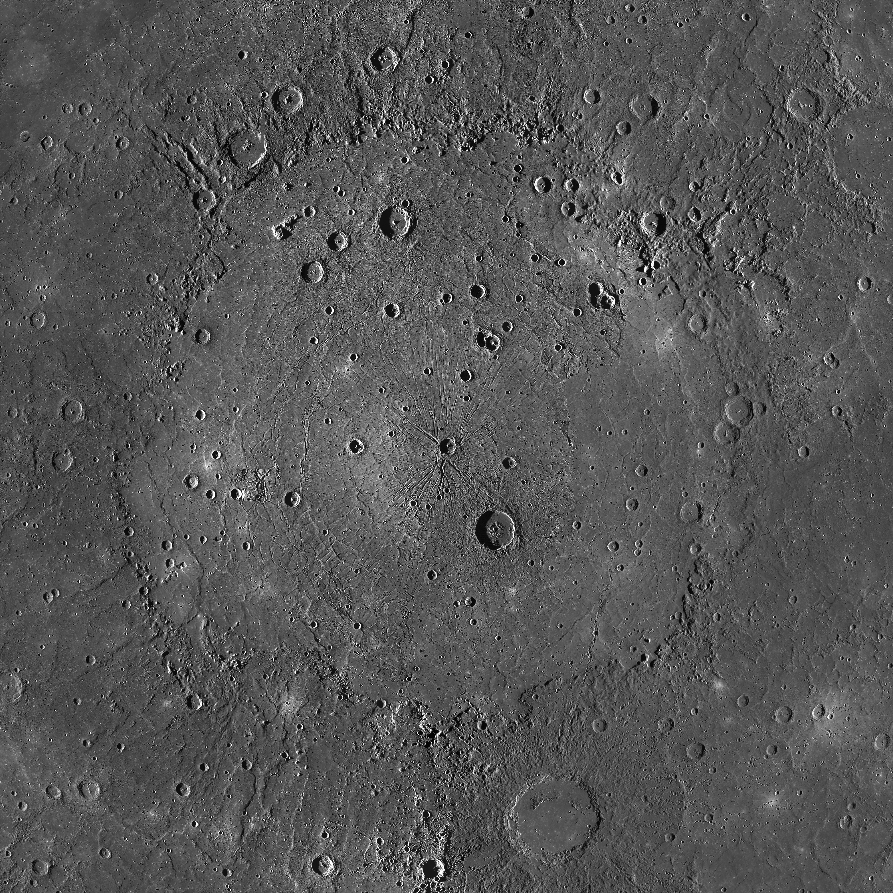
 Click on image to enlarge. | The Mighty CalorisRelease Date: February 23, 2015 Topics: Caloris, HD Resolution Images, Mosaics, Pantheon Fossae, Smooth Terrain, Tectonics, Volcanism |
Instrument: Mercury Dual Imaging System (MDIS)
Approximate Latitude Range: 3°N to 57°N
Longitude Range: 132°E to 196°E
Center Latitude: 31.5°N
Center Longitude: 162.7°E
Resolution: 250 meters/pixel
Scale: Caloris basin is approximately 1525 km (948 mi.) across
Projection: Orthographic
Of Interest: This is an MDIS mosaic of the mighty Caloris basin, Mercury's youngest large impact basin. Caloris has been filled by volcanic plains that are distinctive in color from the surrounding terrain. Subsequent craters have excavated low-reflectance material from beneath these volcanic plains, possibly giving clues to the composition of the basin floor. The basin interior has a complex tectonic history. The interior smooth plains have an area of 1.72 million km2 (0.66 million mi2), approximately the area of Alaska! Over 640 Rhode Islands would fit inside of this massive basin!
Click here for a full-resolution version of the mosaic (71 MB) to explore Caloris in all its glory.
Tune in Wednesday for a color mosaic of Caloris basin!
The MESSENGER spacecraft is the first ever to orbit the planet Mercury, and the spacecraft's seven scientific instruments and radio science investigation are unraveling the history and evolution of the Solar System's innermost planet. In the mission's more than three years of orbital operations, MESSENGER has acquired over 250,000 images and extensive other data sets. MESSENGER is capable of continuing orbital operations until early 2015.
Credit: NASA/Johns Hopkins University Applied Physics Laboratory/Carnegie Institution of Washington
For information regarding the use of MESSENGER images, see the image use policy.