 Click on image to enlarge. | Explore Mercury in Map-a-Planet!Release Date: December 15, 2009 Topics: Global Views, Mercury Flyby 1, Mercury Flyby 2, Mercury Flyby 3, Mosaics, |
Date of Mercury Flyby 1: January 14, 2008
Date of Mercury Flyby 2: October 6, 2008
Date of Mercury Flyby 3: September 29, 2009
Instrument: Narrow Angle Camera (NAC) of the Mercury Dual Imaging System (MDIS)
Scale: Mercury's diameter is 4880 kilometers (3030 miles)
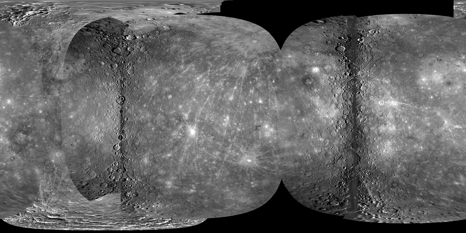
Of Interest: Today, the first high-resolution global map of Mercury was made publicly available! Members of the MESSENGER team and experts from the U. S. Geological Survey (USGS) used images from MESSENGER's three Mercury flybys and from the Mariner 10 mission in 1974-75 to create a global mosaic that covers 97.7% of Mercury's surface at a resolution of 500 meters/pixel (0.31 miles/pixel). The new mosaic is also being described today to the scientific community at a presentation at the American Geophysical Union Fall Meeting in San Francisco. Read the full press release for more details.
The above image shows the full global Mercury mosaic but at a greatly reduced scale of only 5% of the high-resolution version. Explore the full high-resolution mosaic by visiting the USGS Map-a-Planet website!
Date of Mercury Flyby 2: October 6, 2008
Date of Mercury Flyby 3: September 29, 2009
Instrument: Narrow Angle Camera (NAC) of the Mercury Dual Imaging System (MDIS)
Scale: Mercury's diameter is 4880 kilometers (3030 miles)
Of Interest: Today, the first high-resolution global map of Mercury was made publicly available! Members of the MESSENGER team and experts from the U. S. Geological Survey (USGS) used images from MESSENGER's three Mercury flybys and from the Mariner 10 mission in 1974-75 to create a global mosaic that covers 97.7% of Mercury's surface at a resolution of 500 meters/pixel (0.31 miles/pixel). The new mosaic is also being described today to the scientific community at a presentation at the American Geophysical Union Fall Meeting in San Francisco. Read the full press release for more details.
The above image shows the full global Mercury mosaic but at a greatly reduced scale of only 5% of the high-resolution version. Explore the full high-resolution mosaic by visiting the USGS Map-a-Planet website!
Credit: NASA/Johns Hopkins University Applied Physics Laboratory/Carnegie Institution of Washington/U. S. Geological Survey/Arizona State University
For information regarding the use of MESSENGER images, see the image use policy.