 Click on image to enlarge. | An Angular Albedo ArcRelease Date: July 18, 2011 Topics: Albedo Contrasts, Crater Rays |
Date acquired: June 21, 2011
Image Mission Elapsed Time (MET): 217183900
Image ID: 409241
Instrument: Wide Angle Camera (WAC) of the Mercury Dual Imaging System (MDIS)
WAC filter: 7 (748 nanometers)
Center Latitude: 30.53°
Center Longitude: 226.2° E
Resolution: 343 meters/pixel
Scale: The diagonal length of this image is about 500 km (310 mi) across.
Incidence Angle: 54.3°
Emission Angle: 0.3°
Phase Angle: 54.1°
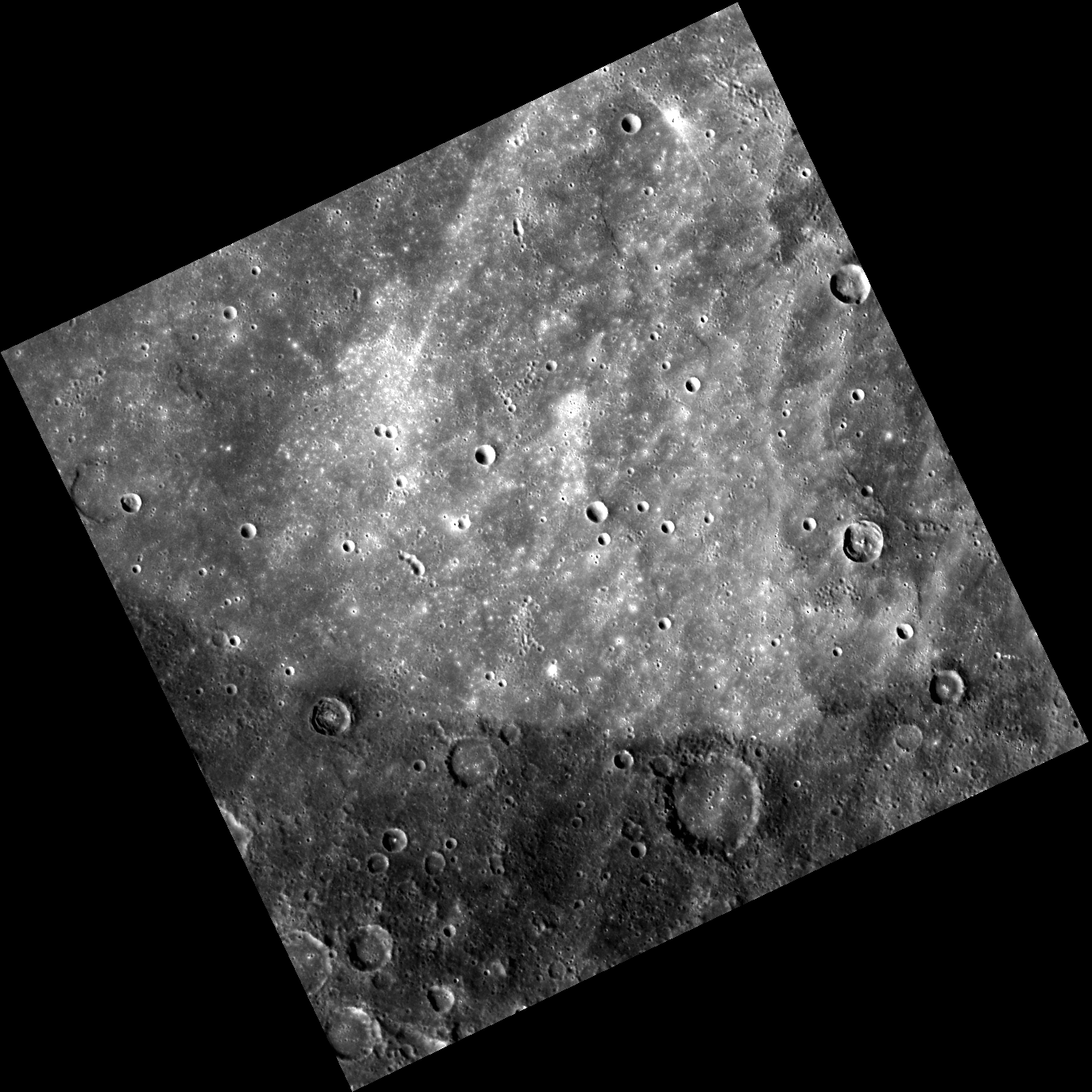
Of Interest: A distinct albedo difference is visible in this image, separating lighter, smoother ground in the north from darker, older terrain in the south. This contrast is likely indicative of a compositional difference between the two terrains. Although at first glance this feature seems angular, the albedo change most likely marks the edge of an extremely degraded impact basin.
This image was acquired as part of MDIS's high-resolution surface morphology base map. The surface morphology base map will cover more than 90% of Mercury's surface with an average resolution of 250 meters/pixel (0.16 miles/pixel or 820 feet/pixel). Images acquired for the surface morphology base map typically have off-vertical Sun angles (i.e., high incidence angles) and visible shadows so as to reveal clearly the topographic form of geologic features.
The MESSENGER spacecraft is the first ever to orbit the planet Mercury, and the spacecraft's seven scientific instruments and radio science investigation are unraveling the history and evolution of the Solar System's innermost planet. Visit the Why Mercury? section of this website to learn more about the key science questions that the MESSENGER mission is addressing. During the one-year primary mission, MDIS is scheduled to acquire more than 75,000 images in support of MESSENGER's science goals.
Image Mission Elapsed Time (MET): 217183900
Image ID: 409241
Instrument: Wide Angle Camera (WAC) of the Mercury Dual Imaging System (MDIS)
WAC filter: 7 (748 nanometers)
Center Latitude: 30.53°
Center Longitude: 226.2° E
Resolution: 343 meters/pixel
Scale: The diagonal length of this image is about 500 km (310 mi) across.
Incidence Angle: 54.3°
Emission Angle: 0.3°
Phase Angle: 54.1°
Of Interest: A distinct albedo difference is visible in this image, separating lighter, smoother ground in the north from darker, older terrain in the south. This contrast is likely indicative of a compositional difference between the two terrains. Although at first glance this feature seems angular, the albedo change most likely marks the edge of an extremely degraded impact basin.
This image was acquired as part of MDIS's high-resolution surface morphology base map. The surface morphology base map will cover more than 90% of Mercury's surface with an average resolution of 250 meters/pixel (0.16 miles/pixel or 820 feet/pixel). Images acquired for the surface morphology base map typically have off-vertical Sun angles (i.e., high incidence angles) and visible shadows so as to reveal clearly the topographic form of geologic features.
The MESSENGER spacecraft is the first ever to orbit the planet Mercury, and the spacecraft's seven scientific instruments and radio science investigation are unraveling the history and evolution of the Solar System's innermost planet. Visit the Why Mercury? section of this website to learn more about the key science questions that the MESSENGER mission is addressing. During the one-year primary mission, MDIS is scheduled to acquire more than 75,000 images in support of MESSENGER's science goals.
Credit: NASA/Johns Hopkins University Applied Physics Laboratory/Carnegie Institution of Washington
For information regarding the use of MESSENGER images, see the image use policy.