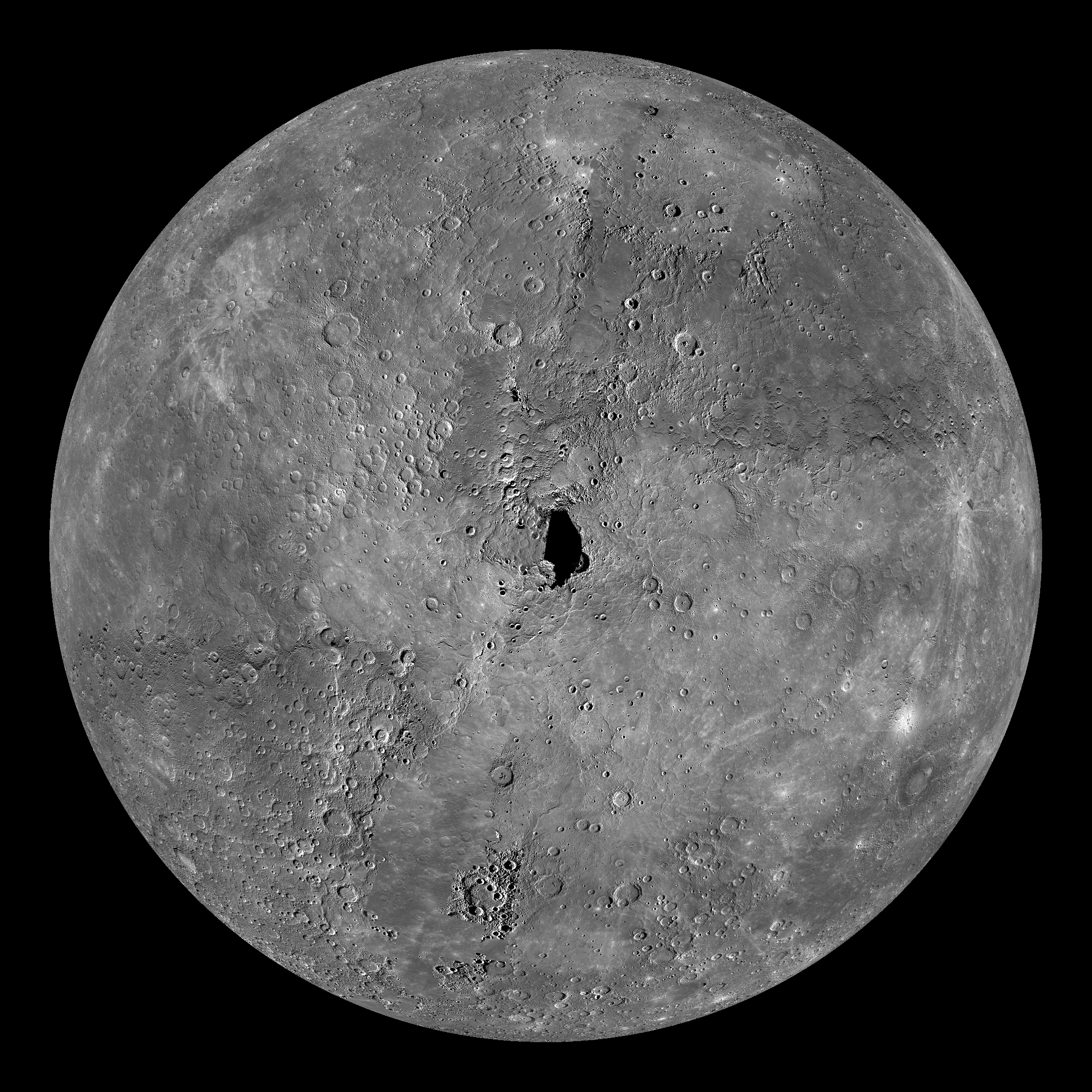
 Click on image to enlarge. | Mercury Globe: North PoleRelease Date: December 2, 2011 Topics: Global Views, HD Resolution Images, Mosaics, Polar, Volcanism |
Instrument: Narrow Angle Camera (NAC) and Wide Angle Camera (WAC) of the Mercury Dual Imaging System (MDIS)
Resolution: 2.5 km/pixel
Scale: Mercury's diameter is 4880 kilometers (3030 miles)
Map Projection: orthographic
Center Latitude: 90°
Of Interest: The above image shows an orthographic projection of this global mosaic centered on Mercury's north pole. 0° longitude is down in this image. The black area at the center of this view represents the only remaining image coverage gap of Mercury when using both Mariner 10 and MESSENGER data. The north polar region of Mercury includes a vast area of smooth plains. Hokusai crater is visible just down from center, although its tremendous rays are not prominent under these lighting conditions.
The MESSENGER spacecraft is the first ever to orbit the planet Mercury, and the spacecraft's seven scientific instruments and radio science investigation are unraveling the history and evolution of the Solar System's innermost planet. Visit the Why Mercury? section of this website to learn more about the key science questions that the MESSENGER mission is addressing. During the one-year primary mission, MDIS is scheduled to acquire more than 75,000 images in support of MESSENGER's science goals.
Credit: NASA/Johns Hopkins University Applied Physics Laboratory/Carnegie Institution of Washington
For information regarding the use of MESSENGER images, see the image use policy.