 Click on image to enlarge. | Illumination Map of Mercury's South PoleRelease Date: March 21, 2012 Topics: Chao Meng-Fu, Color Images, HD Resolution Images, Polar, Shadow and Water Ice |
Presented at: A press conference held at the 43rd Lunar and Planetary Science Conference, The Woodlands, Texas, USA. In total, MESSENGER team members are presenting 57 papers at this conference.
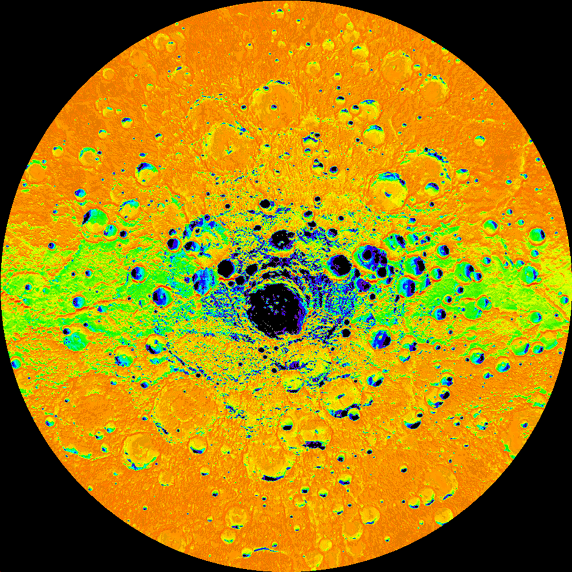
Scale: The large crater near Mercury's south pole, Chao Meng-Fu, has a diameter of 180 km
Map Information: This illumination map is shown in polar stereographic projection, extending northward to 73° S, and 0° longitude is at the top
Of Interest: Shown here is an illumination map of Mercury's south polar region. The map is colored on the basis of the percentage of time that a given area is sunlit; areas appearing black in the map are regions of permanent shadow. This map was created by using 89 wide-angle camera (WAC) images of Mercury's south polar region acquired by the Mercury Dual Imaging System (MDIS) over one complete Mercury solar day (176 Earth days) which can be viewed in this movie. Radar-bright deposits, which may be water ice, collocate with regions of permanent shadow.
The MESSENGER spacecraft is the first ever to orbit the planet Mercury, and the spacecraft's seven scientific instruments and radio science investigation are unraveling the history and evolution of the Solar System's innermost planet. Visit the Why Mercury? section of this website to learn more about the key science questions that the MESSENGER mission is addressing. During the one-year primary mission, MDIS acquired 88,746 images and extensive other data sets. MESSENGER is now in a yearlong extended mission, during which plans call for the acquisition of more than 80,000 additional images to support MESSENGER's science goals.
Credit: NASA/Johns Hopkins University Applied Physics Laboratory/Carnegie Institution of Washington
For information regarding the use of MESSENGER images, see the image use policy.