 Click on image to enlarge. | (How Does It Feel to Be) On Top of the World?Release Date: September 21, 2012 Topics: Mozart, |
Date acquired: May 07, 2011
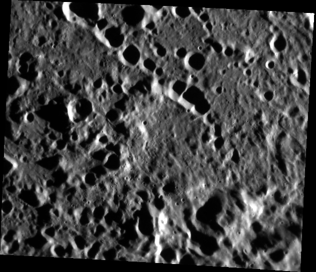
Image Mission Elapsed Time (MET): 213240294
Image ID: 222814
Instrument: Narrow Angle Camera (NAC) of the Mercury Dual Imaging System (MDIS)
Center Latitude: 11.95°
Center Longitude: 164.7° E
Resolution: 191 meters/pixel
Scale: The scene is about 115 km (71 mi.) across
Incidence Angle: 79.0°
Emission Angle: 32.1°
Phase Angle: 111.1°
Of Interest: Today's image shows a part of the ejecta blanket of the Mozart basin. The hill at the bottom center of the image has the highest elevation measured by the Mercury Laser Altimeter (MLA), just over 4 km above the reference. A paper on findings related to Mercury's topography was published by Maria Zuber and colleagues in the journal Science.
This image was acquired as part of MDIS's high-resolution surface morphology base map. The surface morphology base map covers more than 99% of Mercury's surface with an average resolution of 200 meters/pixel. Images acquired for the surface morphology base map typically are obtained at off-vertical Sun angles (i.e., high incidence angles) and have visible shadows so as to reveal clearly the topographic form of geologic features.
The MESSENGER spacecraft is the first ever to orbit the planet Mercury, and the spacecraft's seven scientific instruments and radio science investigation are unraveling the history and evolution of the Solar System's innermost planet. Visit the Why Mercury? section of this website to learn more about the key science questions that the MESSENGER mission is addressing. During the one-year primary mission, MESSENGER acquired 88,746 images and extensive other data sets. MESSENGER is now in a yearlong extended mission, during which plans call for the acquisition of more than 80,000 additional images to support MESSENGER's science goals.
Credit: NASA/Johns Hopkins University Applied Physics Laboratory/Carnegie Institution of Washington
For information regarding the use of MESSENGER images, see the image use policy.