 Click on image to enlarge. | A World ViewRelease Date: October 29, 2012 Topics: Global Views, HD Resolution Images, Mosaics |
Date Released: September 7, 2012
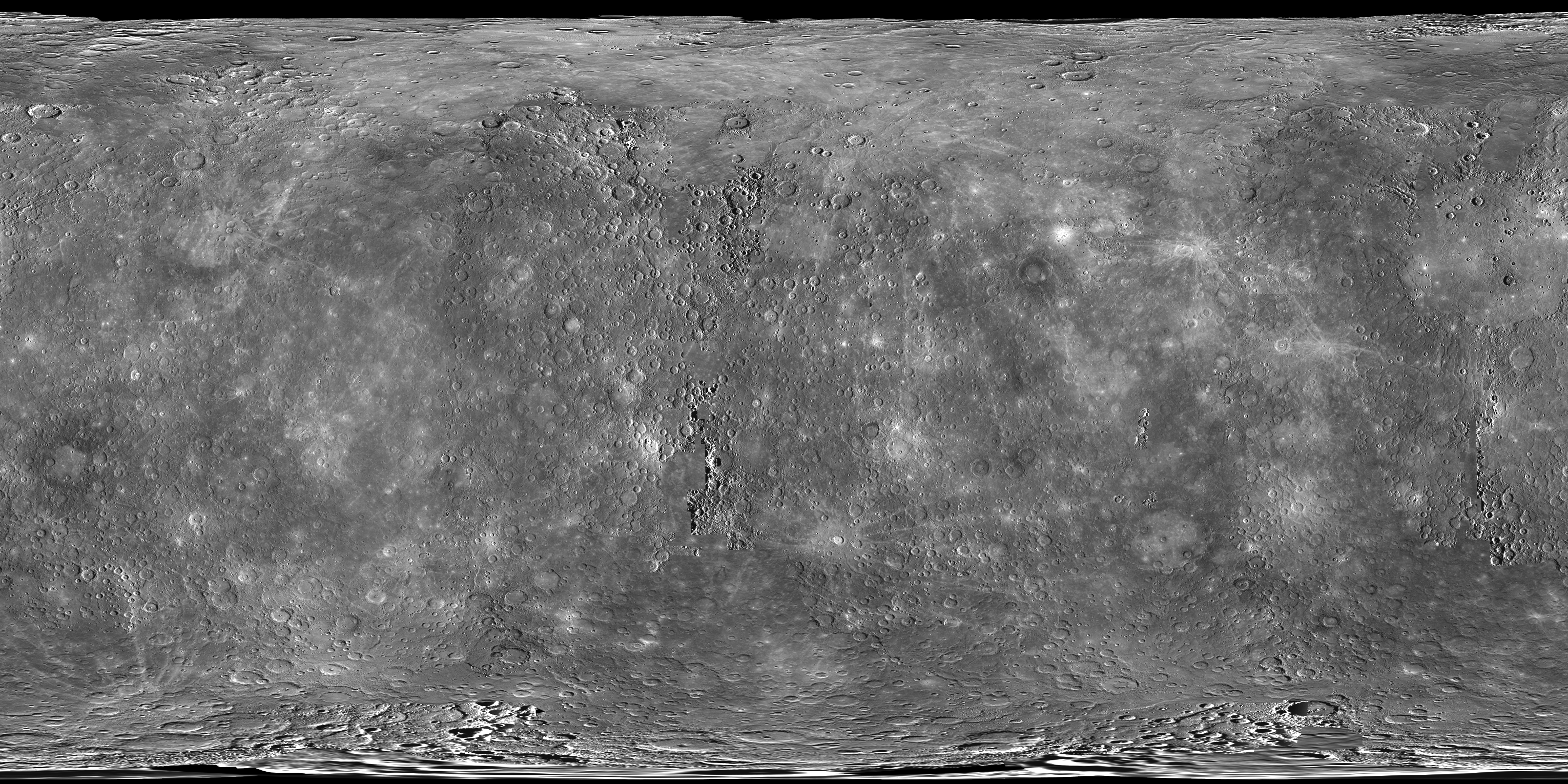
Instrument: Mercury Dual Imaging System (MDIS)
Center Latitude: 0°
Center Longitude: 0° E
Resolution: 5 kilometers/pixel
Scale: Mercury's diameter is 4880 kilometers (3030 miles).
Map Projection: simple cylindrical
Of Interest: As of last month, all of the data acquired during MESSENGER's one-year primary mission are available at NASA's Planetary Data System (PDS). The mosaic above is a global view of Mercury assembled from images in the PDS and covers >99.9% of the surface. Download larger versions of this mosaic, at resolutions up to 250 m/pixel, from this global mosaics webpage. Or, explore this mosaic interactively using the QuickMap tool! It's also interesting to remember that prior to the MESSENGER mission, only 45% of Mercury's surface had been seen by spacecraft!
The MESSENGER spacecraft is the first ever to orbit the planet Mercury, and the spacecraft's seven scientific instruments and radio science investigation are unraveling the history and evolution of the Solar System's innermost planet. Visit the Why Mercury? section of this website to learn more about the key science questions that the MESSENGER mission is addressing. During the one-year primary mission, MESSENGER acquired 88,746 images and extensive other data sets. MESSENGER is now in a yearlong extended mission, during which plans call for the acquisition of more than 80,000 additional images to support MESSENGER's science goals.
Credit: NASA/Johns Hopkins University Applied Physics Laboratory/Carnegie Institution of Washington
For information regarding the use of MESSENGER images, see the image use policy.