 Click on image to enlarge. | Looking Toward Mercury's North PoleRelease Date: October 24, 2008 Topics: Mercury Flyby 2, |
Date Acquired: October 6, 2008
Image Mission Elapsed Time (MET): 131774343
Instrument: Narrow Angle Camera (NAC) of the Mercury Dual Imaging System (MDIS)
Resolution: 580 meters/pixel (0.36 miles/pixel) at bottom of image
Scale: Bottom edge of image is about 590 kilometers (370 miles) across
Spacecraft Altitude: 22,700 kilometers (14,100 miles)
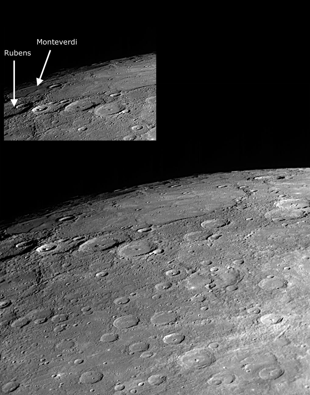
Of Interest: A dominant feature in this NAC image is the large expanse of smooth plains in the upper left of the view. It may be related to extensive plains in Mercury's high northern latitudes that were identified in Mariner 10 images. The craters Rubens (named for the 17th century Flemish painter) and Monteverdi (named for the Italian composer of the late 1500s and early 1600s) are located near the western edge of the unimaged “gore” region in the Mariner 10 coverage of Mercury's surface; most of the surface to the east of these craters is newly imaged terrain. Also visible just right of center in this image is the impressive cliff shown in greater detail in an October 10 image release.
Image Mission Elapsed Time (MET): 131774343
Instrument: Narrow Angle Camera (NAC) of the Mercury Dual Imaging System (MDIS)
Resolution: 580 meters/pixel (0.36 miles/pixel) at bottom of image
Scale: Bottom edge of image is about 590 kilometers (370 miles) across
Spacecraft Altitude: 22,700 kilometers (14,100 miles)
Of Interest: A dominant feature in this NAC image is the large expanse of smooth plains in the upper left of the view. It may be related to extensive plains in Mercury's high northern latitudes that were identified in Mariner 10 images. The craters Rubens (named for the 17th century Flemish painter) and Monteverdi (named for the Italian composer of the late 1500s and early 1600s) are located near the western edge of the unimaged “gore” region in the Mariner 10 coverage of Mercury's surface; most of the surface to the east of these craters is newly imaged terrain. Also visible just right of center in this image is the impressive cliff shown in greater detail in an October 10 image release.
Credit: NASA/Johns Hopkins University Applied Physics Laboratory/Carnegie Institution of Washington
For information regarding the use of MESSENGER images, see the image use policy.